
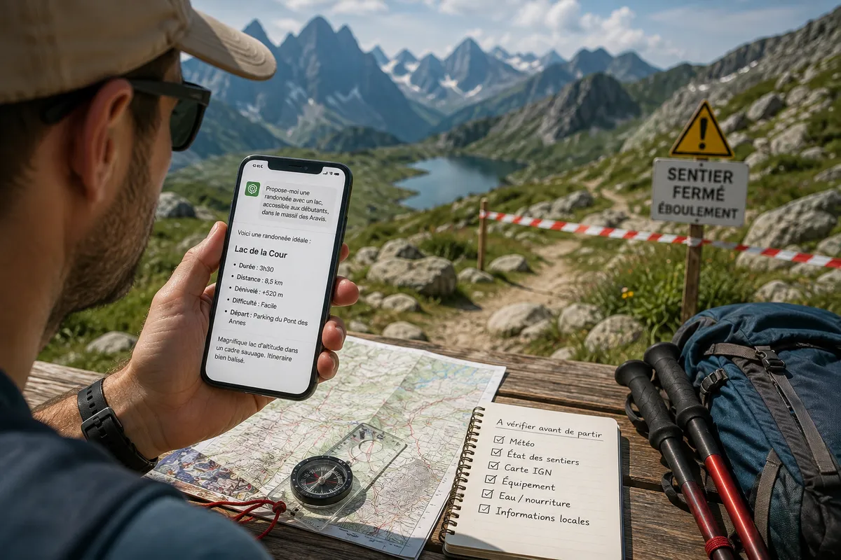
Asking ChatGPT or an AI to map out your next mountain trek seems like a brilliant idea. However, on the ground, these algorithm-generated routes often turn out to be real traps. Underestimated distances, forbidden bivouacs, exposed passages forgotten: guides and rescuers are sounding the alarm in the face of increasing incidents.
When AI goes off track: chilling anecdotes
Testimonies from hikers trapped by a generative artificial intelligence are multiplying in the French mountain ranges:
- In the Hautes-Pyrénées: Two female hikers found themselves completely disoriented after following to the letter a track mapped out by ChatGPT. In the same area, a group of people in their forties came back soaked and freezing from a “crazy route” of 40 km across steep peaks.
- In the Cévennes: A father and his son submitted an 82 km two-day itinerary created by AI to park agents, planning a night in a hammock at 800 meters altitude. An unrealistic itinerary, taking into account neither the freezing weather nor the strict ban on bivouac in this area.
In tourist offices and park visitor centers, the observation is alarming: searching on ChatGPT is beginning to replace classic research, leading walkers on the ground equipped only with a phone and blind trust in the machine.
Why algorithms hallucinate on hiking maps
An artificial intelligence like ChatGPT does not “know” the mountains: it predicts words based on data collected from the web. This mechanism creates major flaws when planning a hike.
1. Fantastical elevation gains and distances
AIs often assemble trail sections that do not connect in reality or underestimate the effort required in the mountains. The result: a walk sold as “easy” can involve an elevation gain worthy of a challenging trail race.
2. Blindness to terrain and current conditions
The AI is unable to know that a trail was washed away by a landslide last spring, that a late snowfield blocks a dangerous pass, or that the weather forecast warns of terrible conditions. It relies on sometimes outdated static descriptions.
3. Ignorance of local regulations
Bivouac regulation, municipal decrees, wildlife quiet zones or nature reserves: the AI regularly suggests camping where it is strictly forbidden under penalty of fine.
AI doesn’t know who you are (and that’s the biggest danger)
Beyond map errors, the major problem lies in the subjectivity of physical level.
As professionals from the Compagnie des Guides de Chamonix or the mountain gendarmerie units (PGHM) remind us, an itinerary rated “medium” can become extremely dizzying or exposed to rockfall depending on the chosen variants.
“The whole point of consulting a guide or a professional is to adapt the route to real physical abilities, equipment, and individual apprehensions. AI will never ask you these vital questions before departure.”
Good practices for using AI without putting yourself in danger
Should AI tools be completely banned then? Not necessarily. They can serve as an inspiration engine to find ideas for valleys or themed trips. But validation must imperatively remain human.
To succeed in your mountain outings:
- Cross-check systematically with official maps: Use recognized mapping applications (IGN Géoportail, SwissTopo) to verify the exact route and the true elevation gain.
- Consult local actors: Tourist offices, Park Visitor Centers, and guide offices provide real-time information on trail conditions and local weather.
- Anticipate regulations: Check if your itinerary passes through a nature reserve subject to specific rules regarding dogs, bivouac, or fire.
What to use instead of AI? Essential apps and tools for hiking safely
To prepare an itinerary without risking the errors of a generative algorithm, it is better to rely on proven mapping tools updated by geographers or the practitioners’ community.
1. Reference mapping applications
- Geoportail / IGN Map (Carto): The must-have for France. Accessing the TOP 25 base map allows precise analysis of contour lines, terrain type (forest, rock outcrops), and exact slope => IGN official site
- Visorando & Altituderando: Two reference platforms fueled by passionate hikers and moderated by expert teams. Hiking sheets are regularly updated with recent opinions on trail conditions.
- Komoot & Outdooractive: Ideal for generating tailored routes based on your discipline (trail, hike, bivouac), these apps rely on OpenStreetMap data and integrate real elevation gain as well as surface type (trail, technical path, pavement).
2. Official sources for terrain and weather
- Météo-France (Snow and Avalanche Bulletin / Mountain): Essential before setting out at altitude to know the risks of storms, the zero-degree isotherm, or avalanche risk early in the season.
- National and Regional Parks portals: Platforms like Rando Vanoise, Rando Écrins, or the Haute-Savoie Nature Reserves sites list trail opening statuses and remind exact rules regarding bivouac and dog presence.
- A quick call to refuge keepers: No one knows the terrain better than a keeper living at altitude. A quick call can tell you if a pass is still snow-covered or if a spring has dried up.